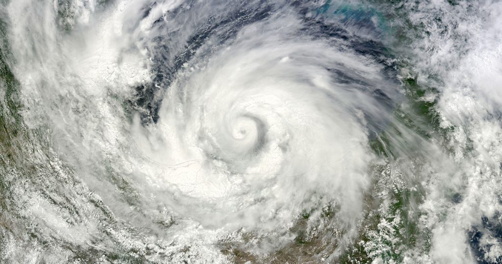
June 1 is the official kick-off date of the Atlantic hurricane season. For the last three years, the pre-season forecast has ominously pointed to “above normal” activity; but 2023 looks rather less predictable. A rare three-year La Niña, also known as a “triple-dip” event, is the cause of uncertainty, and NOAA National Weather Service has cited a 90% chance that an El Niño event will occur over the coming months and persist into winter.
Broadly speaking, El Niño conditions favor greater cyclone development in the Western Pacific as opposed to the Atlantic Basin, so there is a suggestion that hurricane season may, in fact, be less active in 2023.
NOAA’s most recently updated 2023 Atlantic Hurricane Season Outlook, published May 25, appears to concur, now predicting a “near-normal” hurricane season—12–17 named storms, including 5–9 hurricanes, 1–4 of which may develop into major hurricanes.
Building Robust Forecast Models with Ocean Tech
However, populations up and down the US East Coast and the Gulf of Mexico will take little comfort from the chance of “below normal” activity, though. When it comes to greenlighting hurricane preparations and ordering mandatory evacuations, modeling forecasts that include even a hint of uncertainty only serves to compound the stress of the situation. It is widely agreed that forecasts of major weather events over land tend to be more accurate, but when predicting storm intensity and track over water, there is still much to be improved.
What we do know with statistical clarity is that hurricanes and tropical storms have historically increased in intensity and occurrence over time. While today’s scientific hurricane models—vital tools for emergency management and coastal protection—are more robust than ever, enhancing their accuracy and utility walks hand in hand with the scale at which researchers can collect and process critical ocean-based data. This rate of progress, in turn, leans heavily on the development, deployment, and monitoring of sophisticated ocean technology.
Upgrades to current ocean observing systems have allowed hurricane researchers to expand our understanding of how tropical cyclones interact with the ocean’s surface. Ongoing investments in ocean tech, such as ocean buoys, will continue to bring us more data to validate forecast models. Extending the reach of measurements further down into the water column—to the ocean’s mixed layer, for example—will unlock insights into the impacts of ocean heat.
Network Integration
As the Blue Economy develops, broadening the capacity of ocean monitoring systems and the sensors they support means identifying new opportunities to leverage existing infrastructure in the marine domain. Take subsea cables; while the number of in-service subsea fiber optic cables is in constant flux—with new cable connections coming online and others being decommissioned, all to the backdrop of explosive demand for faultless broadband—there are well over a million kilometers of active cables on the seafloor. And that’s just the telecom sector’s contribution; With aggressive plans for offshore wind build out around the world, submarine power cables offer even more mileage for technologists to help integrate subsea cables in support of environmental monitoring. By leveraging the cable infrastructure that is already in place, ocean scientists have the capacity to optimize ocean observations by integrating sensors for ocean bottom temperature, pressure, and seismic acceleration. Such cables are known as Science Monitoring and Reliable Telecommunications (SMART) Subsea Cables, and outside of applications for hurricane forecasting and coastal readiness, subsea cables also provide integrated capabilities for other ocean issues like Tsunami early warning, earthquake recognition, ocean acidification, ocean warming, and volcanic activity.
Finding 21st solutions to advancing the utility of existing submarine communication networks and developing technologies to advance ocean observing systems is central to some of the work we do at OSI. In 2021 OSI joined forces with Samara/Data to form Subsea Data Systems (SDS), a full-service provider of SMART cable hardware, software, operations, and data management solutions for subsea cable network developers.
We are also working on a number of highly custom ocean observing technologies like our patented Sea-2-Sat Variable Buoy (STSVB) system and the OceanHub. The STSVB system allows subsea sensors and equipment to link to satellite communications in a protected manner and in a wide range of water depths.
Find out more about OSI and their network development services at https://oceanspecialists.com/services.
