Post-war threats may remain in waters previously impacted by naval conflict, such as abandoned and unused munitions, mines, bombs, torpedoes, and shells, also known as unexploded ordnance (UXO), which have the potential for catastrophic risk to life. Over time, a UXO can become scattered, buried under coastal sediment layers, or snagged in coastal lagoons, and the capacity to locate, identify, and ultimately diffuse such devices is of ongoing critical importance.
UXOs can significantly jeopardize ocean industry planning and operations, especially on projects involving subsea pipelines and cables, dredging, and offshore infrastructure development of offshore wind, tidal, and oil & gas platforms. To mitigate any operational risk and ensure the safety and integrity of such structures, highly orchestrated and tech-led UXO surveys are performed to identify and characterize potential hazards.
UXO surveys are traditionally carried out using a towed array equipped with sensors and instruments capable of detecting ferrous anomalies, such as magnetometers. In shallow waters, conventional UXO survey methods—traditionally conducted from a support vessel—can present additional navigational challenges associated with vessel draft, further compounding the potential risk to any topside personnel. To mitigate such exposure, UXO survey solutions are increasingly delivered by remote and autonomous systems and technologies designed to keep people out of harm’s way.
Uncrewed Surface Vehicles
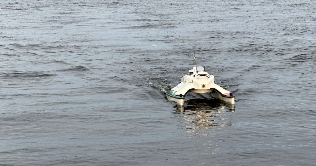
In January 2024, Ocean Specialists, Inc. (OSI) supported SeaView Geophysical in performing a shallow water hazard identification survey in advance of a planned UXO survey offshore coastal North Carolina. OSI provided one of its USVs, an SR-Surveyor M1.8, to render high-resolution imagery of the immediate underwater environment.
The SeaRobotics SR-Surveyor M1.8, from the company’s SR Surveyor Class of USVs, is a payload-customizable platform offering high maneuverability in hard-to-navigate, shallow waters. This fully integrated, person-portable USV is equipped with a payload suited to a wide range of missions, including terrestrial mapping, search and rescue, inspection, habitat mapping, and wide swath bathymetry. The SR Surveyor Class, which includes the HYCAT USV designed from the ground up in partnership with Xylem Brands (YSI, SonTek & HYPACK), empowers operators and surveyors to perform optimized and efficient operations—providing quick access to accurate and robust hydrographic data critical to the progress of operators.
Survey Scope
Set on 158 acres of a shallow water estuary, the purpose of the survey was to identify obstacles from the shore to approximately 2.5 m water depth that could present potential hazards to a 4 m wide Advanced Geophysical Classification (AGC) UXO towed array that will be deployed by SeaView Geophysical over the same ground.
Matthew Cook, President of SeaView Geophysical, said: “The SR-Surveyor M1.8 is a very practical platform for safely and efficiently recording side-scan and bathymetry data in shallow, sheltered waters.”
Running 15 m transects over two full days of survey operations, the USV covered the full 158 acres, providing high-quality side-scan data with greater than 100% coverage, and was able to provide bathymetry in water depths as little as 0.5 m. The transect lines were straight and turnaround times were minimal.
To find out more about OSI’s USV service line, visit: https://oceanspecialists.com/services/uncrewed-surface-vessels/